
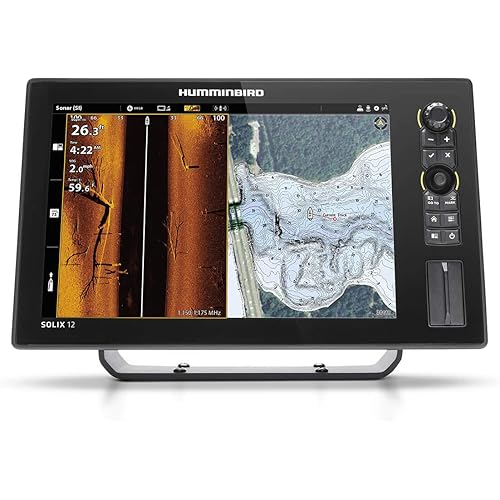
Garmin GPSMAP 943xsv Combo GPS/Fishfinder - Preloaded US+Canada+Bahamas BlueChart g3 - LakeV g3


Buy Now, Pay Later
- – Up to 36-month term if approved
- – No impact on credit to apply
- – Instant approval decision
- – Secure and straightforward checkout
Ready to go? Add this product to your cart and select a plan during checkout.
Payment plans are offered through our trusted finance partners Klarna, Affirm, Afterpay, Apple Pay, and PayTomorrow. No-credit-needed leasing options through Acima may also be available at checkout.
Learn more about financing & leasing here.
This item is eligible for return within 30 days of receipt
To qualify for a full refund, items must be returned in their original, unused condition. If an item is returned in a used, damaged, or materially different state, you may be granted a partial refund.
To initiate a return, please visit our Returns Center.
View our full returns policy here.
Features
- GPSMAP 943xsv chartplotter
- microSD card preinstalled
- Power cable
- NMEA 2000 T-connector
- NMEA 2000 drop cable (2 meters)
- 8-pin transducer to 12-pin sounder adapter cable
- Bail mount kit with knobs
- Flush mount kit with gasket
- Protective cover
- Trim piece snap covers
- Documentation
- GMR 18 HD+ radome
- Mounting hardware kit
- Power cable (15 m)
- Network cable (15 m)
- Installation instructions
- Mounting template
Description
Overview GET A SHARPER VIEW FROM YOUR CONNECTED HELMWith its sleek design, powerful processing and upgraded IPS display, this advanced 7”, 9” or 12” chartplotter integrates seamlessly into your Garmin marine system. Easily integrate with more engines. Connect to compatible third-party devices with OneHelm digital switching. Easily build your marine system using the best of network connectivity. Navigate any waters with preloaded mapping and coastal charts. See below your boat with built-in sonar capabilities. Manage your marine experience from nearly anywhere1. See the world below. ULTRA HIGH- DEFINITION SCANNING SONARGet built-in Ultra High-Definition SideVü and ClearVü scanning sonars with vivid, high-contrast color palettes to help distinguish fish from structure. GPSMAP X3 series also supports 1 kW CHIRP traditional sonar capabilities. PANOPTIX SONAR SUPPORTPair with Panoptix or LiveScope easy-to-interpret live sonar (transducer required, sold separately) to see all around your boat in real time. Made for your helm. FASTER, SHARPER, SMARTERWith its added processing power and new slimline design featuring edge- to-edge glass and a smaller unit footprint, it’s easy to retrofit this plotter in a wider range of dash configurations. IMPROVED DISPLAY OPTICSNew higher- resolution IPS displays for 9” and 12” plotters offer improved sunlight readability and visibility from any angle, with 50% more pixels than previous- generation 9” GPSMAP devices. PRELOADED MAPPING Experience unparalleled coverage and detail with preloaded BlueChart g3 coastal charts and LakeVü g3 inland maps featuring integrated Garmin and Navionics content and Auto Guidance3 technology. OPTIONAL CHARTS AND MAPS Bring a fresh new look and feel to your chartplotter with optional Garmin Navionics+ or premium Garmin Navionics Vision+ cartography featuring integrated coastal/inland content, access to daily updates, Auto Guidance+ technology2 and more. OPTIONAL RADAR BUNDLETo help you avoid weather and traffic on the water, the compact 4 kW GMR 18 HD+ dome radar is available as a bundled option with your GPSMAP chartplotter/sonar package. Sail and navigate with ease. GARMIN SAILASSIST SAILING FEATURESView laylines, race start line guidance, enhanced wind rose, heading and course-over-ground lines, true wind data fields and tide/current/time slider, wind angle, set and drift, wind speed, polars and more3. OPTIONAL PREMIUM NAVIGATION FEATURESThese optional charts offer the best of Garmin and Navionics data, Auto Guidance3 technology and other premium navigation features. SAILING POLARS Use the polar table to see key data, including how fast you should go at a certain wind angle and speed — so you know whether you need to adjust sail trim. GARMIN MARINE NETWORK If you have multiple compatible Garmin devices on your boat, you can share information — such as maps, user data, radar and IP camera video — among them. NMEA 2000 AND NMEA 0183 NETWORKSConnect to compatible autopilots, digital switching, weather, Fusion-Link audio system, media, VHF, AIS and more from one screen. ACTIVECAPTAIN APP Built-in Wi-Fi connectivity pairs with the free all-in-one mobile app for access to the OneChart feature, smart notifications, software updates, Helm, Garmin Quickdraw Community data and more4. INTEGRATED ANT TECHNOLOGY Connect with some of your favorite devices, such as quatix marine watches, gWind Wireless 2 transducers, GNX Wind marine instruments and wireless remote controls. J1939 CONNECTIVITYNow you can connect your chartplotter to different kinds of engines, including select Yamaha engines. ONEHELM FEATUREThis feature brings together all the operations and capabilities of select third-party devices, such as EmpirBus digital switching, on one screen. Show the sea what you’re made of with the quatix 6X Solar smartwatch. Learn More Make confident decisions using GNX Wind Instruments. Learn More 1Requires ActiveCaptain app on your compatible smartphone paired to the GPSMAP 943xsv 2Sold separately 3Auto Guidance is for planning purposes only and does not replace safe navigation operations 4When paired with a compatible smartphone Wi-Fi is a registered trademark of the Wi- Fi Alliance. GPSMAP 943xsv chartplotter microSD card preinstalled Power cable NMEA 2000 T-connector NMEA 2000 drop cable (2 meters) 8-pin transducer to 12-pin sounder adapter cable Bail mount kit with knobs Flush mount kit with gasket Protective cover Trim piece snap covers Documentation GMR 18 HD+ radome Mounting hardware kit Power cable (15 m) Network cable (15 m) Installation instructions Mounting template U.S. & Coastal Canada - Lakes, Rivers and Coastal Marine Charts U.S. North & Great Lakes - Lakes, Rivers and Coastal Marine Charts U.S. South - Lakes, Rivers and Coastal Marine Charts U.S. East - Lakes, Rivers and Coastal Marine Charts U.S. West - Inland and Coastal Marine Charts Canada, Alaska, & Great Lakes - Lakes, Rivers and Coastal Marine Charts Canada North - Lakes, Rivers and Coastal Marine Charts U.S. Inland Maps U.S., East Inland Maps U.S., West Inland Maps Canada Inland Maps Canada Inland Maps U.S., All and Western Canada Coastal Charts Canada Coastal Charts U.S., Cape Cod Coastal Charts U.S., Mendocino, CA to Salina Cruz, MX Coastal Charts U.S., Hawaiian Islands to Mariana Islands Charts Southern Bahamas Coastal Charts Standard Mapping - Emerald Coast Classic Standard Mapping - Emerald Coast Premium Standard Mapping - Emerald Coast Professional Standard Mapping - Florida East Peninsula Classic Standard Mapping - Florida East Peninsula Premium Standard Mapping - Florida East Peninsula Professional Standard Mapping - Florida West Peninsula Classic Standard Mapping - Florida West Peninsula Premium Standard Mapping - Florida West Peninsula Professional Standard Mapping - Florida Keys Classic Standard Mapping - Florida Keys Premium Standard Mapping - Florida Keys Professional Standard Mapping - Florida One Classic Standard Mapping - Florida One Premium Standard Mapping - Florida One Professional Standard Mapping - Gulf Coast Classic Standard Mapping - Gulf Coast Premium Standard Mapping - Gulf Coast Professional Standard Mapping - Louisiana East Classic Standard Mapping - Louisiana East Premium Standard Mapping - Louisiana East Professional Standard Mapping - Louisiana West Classic Standard Mapping - Louisiana West Premium Standard Mapping - Louisiana West Professional Standard Mapping - Louisiana Central Classic Standard Mapping - Louisiana Central Premium Standard Mapping - Louisiana Central Professional Standard Mapping - Louisiana One Classic Standard Mapping - Louisiana One Premium Standard Mapping - Louisiana One Professional Standard Mapping - Mississippi Sound Classic Standard Mapping - Mississippi Sound Premium Standard Mapping - Mississippi Sound Professional Standard Mapping - Texas East Classic Standard Mapping - Texas East Premium Standard Mapping - Texas East Professional Standard Mapping - Texas West Classic Standard Mapping - Texas West Premium Standard Mapping - Texas West Professional Standard Mapping - Texas One Classic Standard Mapping - Texas One Premium Standard Mapping - Texas One Professional TOPO U.S. 24K North Central TOPO U.S. 24K Northeast TOPO U.S. 24K South Central TOPO U.S. 24K Southeast TOPO U.S. 24K Southwest TOPO U.S. 24K West TOPO U.S. 100K TOPO Alaska Enhanced TOPO Boundary Waters TOPO Canada TOPO Canada: West TOPO Canada: Central TOPO Canada: East TOPO Canada: Northwest TOPO Canada: Nunavut Trailhead Series - Appalachian Trail Trailhead Series - Pacific Crest Trail Worldwide Coastal Charts
Brand: Garmin
Model Name: 943xsv
Vehicle Service Type: Boat
Screen Size: 9 Inches
Special Feature: Anti Glare Screen
Connectivity Technology: Bluetooth
Map Type: Coastal/Inland
Included Components: 1 kW CHIRP sonar, Ultra High-Definition SideVü and ClearVü scanning sonars, built-in Wi-Fi, J1939 engine connectivity, OneHelm feature, NMEA 2000 and NMEA 0183 networking, Garmin Marine Network, 10 Hz GNSS (GPS, GLONASS, and Galileo) receiver See more
Audio Output Mode: Stereo
Mounting Type: Panel Mount or Dashboard Mount
Compatible with Vehicle Type: Boat
Screen Size: 9 Inches
Additional Features: Anti Glare Screen
Connectivity Technology: Bluetooth
Map Types: Coastal/Inland
Audio Output Mode: Stereo
Mounting Type: Panel Mount or Dashboard Mount
Operating System: Windows
Touch Screen Type: Capacitive
Display Type: LCD
Human-Interface Input: Buttons
Compatible Devices: Smartphone, Tablet
Control Method: Touch
Are Batteries Included: No
Supported Satellite Navigation System: GLONASS, GPS, Galileo
Compatible Flash Memory Type: microSD
Sport Type: Boating
Brand: Garmin
Model Name: 943xsv
Built-In Media: 1 kW CHIRP sonar, Ultra High-Definition SideVü and ClearVü scanning sonars, built-in Wi-Fi, J1939 engine connectivity, OneHelm feature, NMEA 2000 and NMEA 0183 networking, Garmin Marine Network, 10 Hz GNSS (GPS, GLONASS, and Galileo) receiver
UPC: 753759250553
Manufacturer: Garmin
Model Number: 010-02366-03
Mfr Part Number: 010-02366-03
Item Dimensions L x W x H: 9.2"L x 6.4"W x 3"H
Item Weight: 3.6 Pounds
Frequently asked questions
To initiate a return, please visit our Returns Center.
View our full returns policy here.
- Klarna Financing
- Affirm Pay in 4
- Affirm Financing
- Afterpay Financing
- PayTomorrow Financing
- Financing through Apple Pay
Learn more about financing & leasing here.


Top Amazon Reviews
