




Moab Area West: Klondike Bluffs, Dead Horse Point Map (National Geographic Trails Illustrated Map, 506)




Buy Now, Pay Later
- – 4-month term
- – No impact on credit to apply
- – Instant approval decision
- – Secure and straightforward checkout
Ready to go? Add this product to your cart and select a plan during checkout.
Payment plans are offered through our trusted finance partners Klarna, Affirm, Afterpay, Zip, Apple Pay, and Google Pay. No-credit-needed leasing options through Acima may also be available at checkout.
Learn more about financing & leasing here.
FREE 30-day refund/replacement
To qualify for a full refund, items must be returned in their original, unused condition. If an item is returned in a used, damaged, or materially different state, you may be granted a partial refund.
To initiate a return, please visit our Returns Center.
View our full returns policy here.

Description
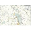
• Waterproof • Tear-Resistant • Topographic MapA premier destination for mountain biking, hiking, whitewater rafting, four-wheeling, and more, Moab offers adventure and recreation in one of the most iconic landscapes in the United States. National Geographic's Trails Illustrated maps of Moab were created in partnership with local land management agencies and adventure experts to provide unmatched detail of the area, with useful up-to-date information to guide and enrich your visit. On the Moab Area West map, particular attention is given to the area's extensive mountain bike trail systems, which are clearly mapped and labeled. This includes the major trail systems west of Moab, including Magnificent Seven, Rodeo, Navajo Rocks, Klondike Bluffs, Bar M (Moab Brands), Amasa Back, Klonzo, Slickrock Trail in the Sand Flats Recreation Area, Sovereign, Dead Horse Point, and the main park road to Devils Garden Trails in Arches National Park. Trails are symbolized by use (hiking, mountain biking, OHV), with trail difficulty indicated for mountain bike trails. Trail segments are labeled with distances between junctions, and all trailheads and trail junctions are labeled with elevations. 4x4 trails are highlighted in yellow with notes for obstacles and features along the route. Group, primitive, and developed campgrounds are shown with their amenities and the total number of sites. Colorado River access points and mileages are mapped and labeled for river recreation. Visitor centers, interpretive trails, and scenic overlooks are prominently mapped and labeled with their amenities. OHV, biker, and desert safety tips, laws, and etiquette are also provided.Every Trails Illustrated map is printed on "Backcountry Tough" waterproof, tear-resistant paper. A full UTM grid is printed on the map to aid with GPS navigation.Other features found on this map include: Colorado River, Green River, Salt Valley.Map Scale = 1:37,500Sheet Size = 37.75" x 25.5"Folded Size = 4.25" x 9.25" Read more
Publisher : National Geographic Maps
Publication date : February 11, 2022
Edition : 2022nd
Language : English
Print length : 2 pages
ISBN-10 : 1566959012
ISBN-13 : 18
Item Weight : 4.8 ounces
Dimensions : 9 x 0.7 x 4.2 inches
Best Sellers Rank: #773,388 in Books (See Top 100 in Books) #810 in United States Atlases & Maps (Books) #1,055 in West Mountain United States Travel Books #1,114 in Maps (Books)
Frequently asked questions
To initiate a return, please visit our Returns Center.
View our full returns policy here.
- Klarna Financing
- Affirm Pay in 4
- Affirm Financing
- Afterpay Financing
- Zip Pay in 4
- Financing through Apple Pay
- Financing through Google Pay
Learn more about financing & leasing here.


